


 Home
Home

Agriculture
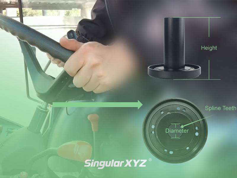
Tech Chat | How can SAgro100 be compatible with most tractors? – Importance of Spline Sleeves
How is the SAgro100 autosteer system compatible with most tractor models? This is the point that most users will care about. In today's blog, we will introduce how spline sleeves work and how to select a suitable spline.
learn more