 Home
Home


Singularpad Field Surveying Software
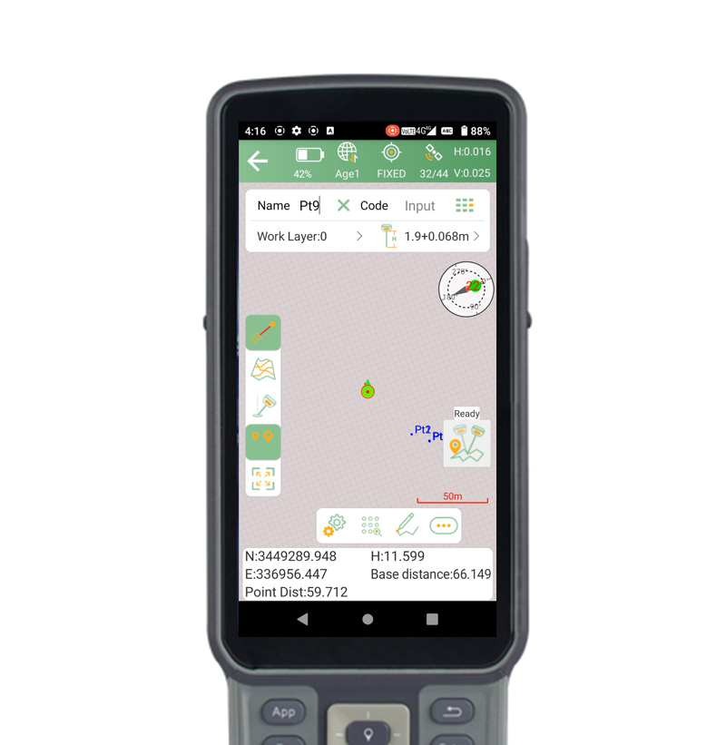
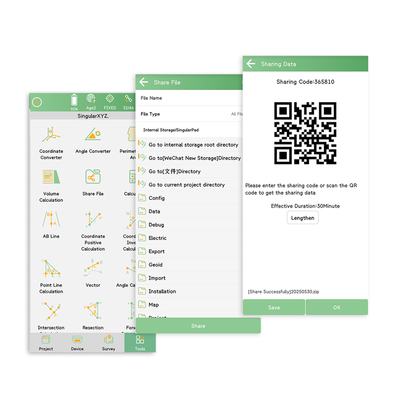
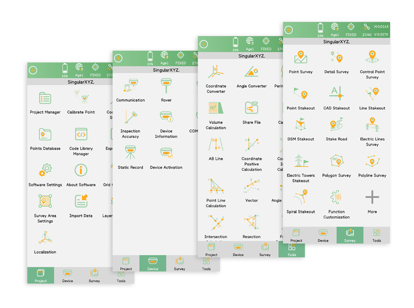
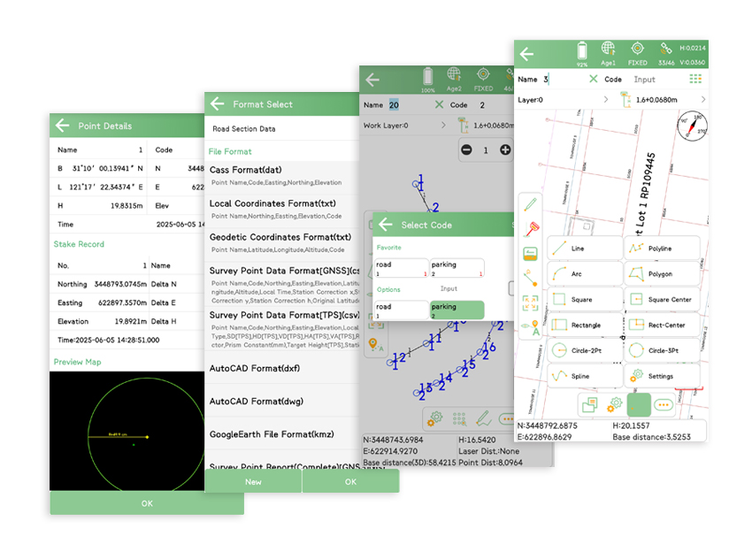
SingularPad is fully functional as a field surveying software, equipped with complete work modes and necessary functions - projection/datum configuraion, GSM/radio/PDA CORS work modes, point survey/stake out/CAD sketch/COGO calculation and etc.
For Both GNSS Receiver & Total Station
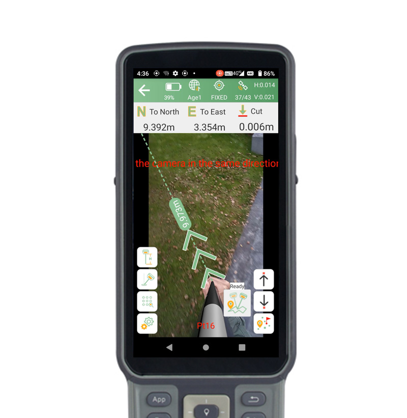
Connected via Bluetooth, both RTK receiver and total station tasks can be performed smoothly under the same project and datum. You can share the real-time stakeout position with prism operators through SingularPad for convenient stakeout.
Professional Design
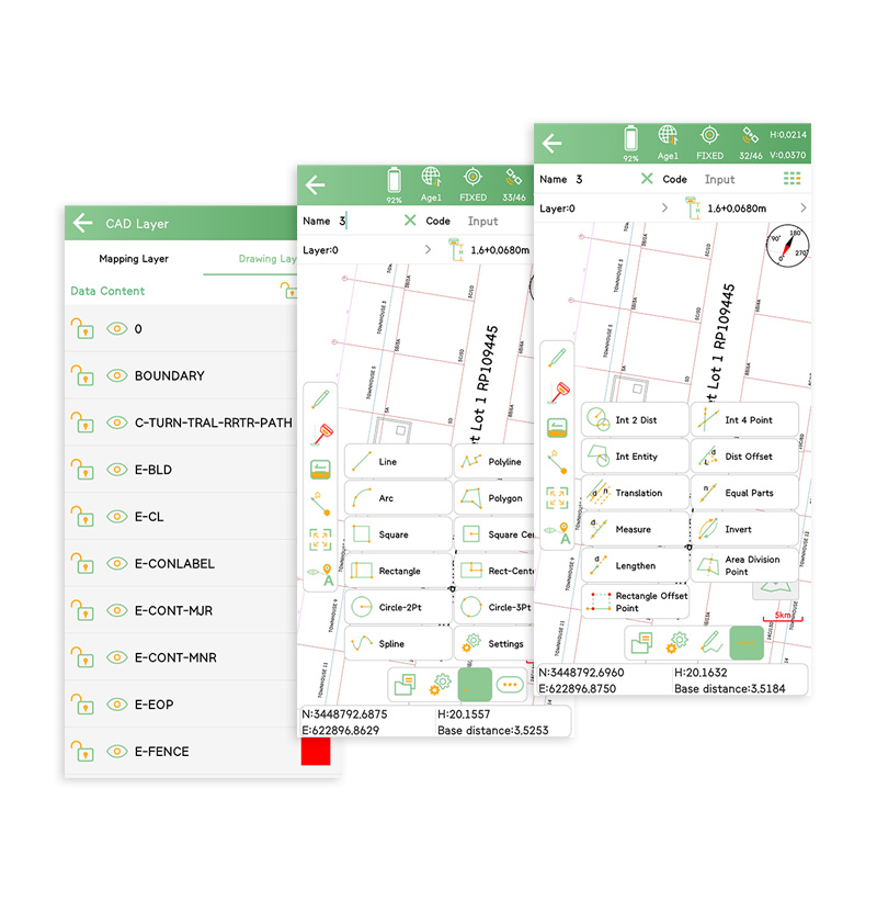
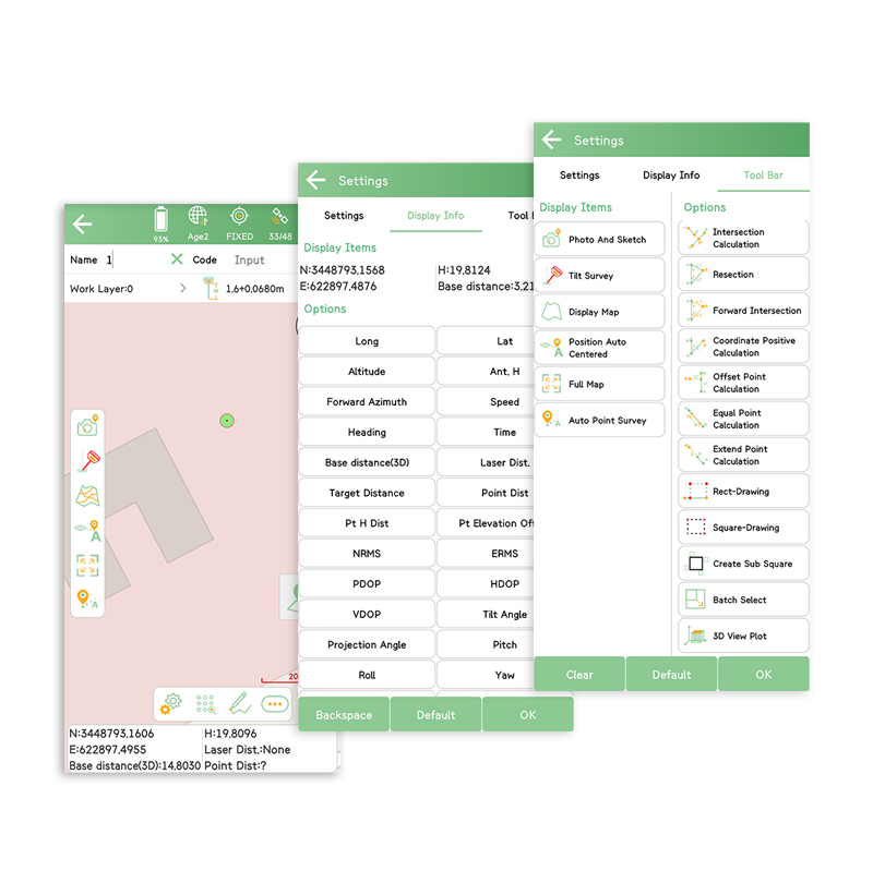
In order to provide professional users with better working experience, SingularPad is designed with more advanced features, such as more import formats, more calculation tools, stake out accuracy analysis, auto-sketching by codes, CAD layer editing and etc.


Full Functionality


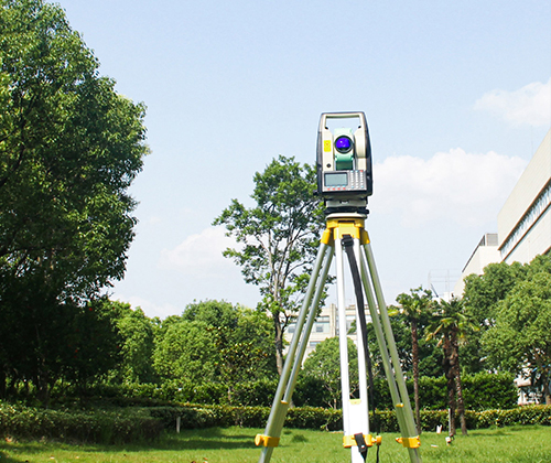
RTK & Total Station


Professional Design