









































































 Home
Home
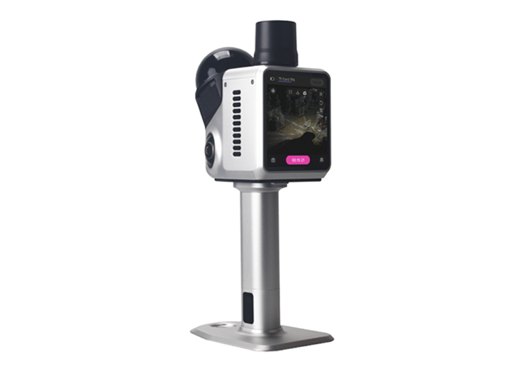
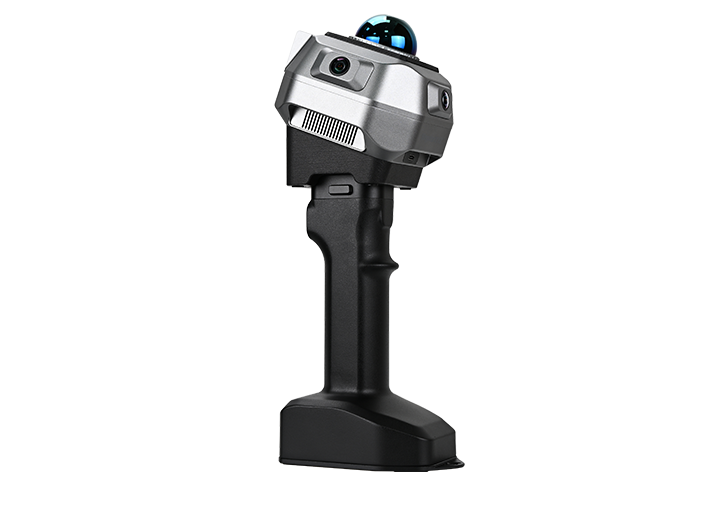
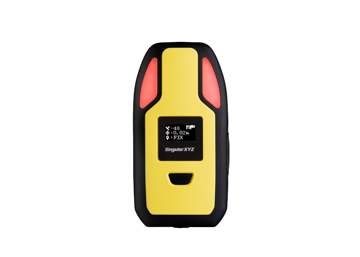
H1 Handheld 3D Laser Scanner
learn more







 2026-07-15
 KALER Soluciones Geomáticas


The H1 Handheld 3D Laser Scanner combines LiDAR SLAM and integrated GNSS technology to deliver fast, accurate, and georeferenced 3D reality capture. Designed for efficient mobile mapping, it enables users to quickly generate dense point clouds and digital site documentation with minimal setup, making it well suited for construction, infrastructure, and other dynamic surveying applications.
In this project, the H1 was deployed to monitor the progress of a construction site in Culiacán, Mexico. By capturing a complete georeferenced 3D representation of the approximately 2,000 m2 site in a single survey, the project team was able to remotely review construction progress, improve supervision efficiency, and reduce the need for frequent site visits.
1. Project Overview
Project Type: Construction and progress monitoring
Location: Culiacán, Mexico
Objective: Generate updated spatial information for monitoring the progress of the construction work
Duration: In Progress
2. Challenges
Frequent travel for the contractor was required to inspect construction progress.
Site updates were difficult to share efficiently with remote project teams.
Traditional documentation methods could not provide fast, comprehensive 3D records for progress tracking.
3. Solution
3.1 Hardware:
H1 Handheld 3D Laser Scanner

3.2 Key Capabilities
H1 Handheld 3D Laser Scanner:
Combine LiDAR SLAM with GNSS for georeferenced point clouds in one workflow.
With the integrated 3.9’ AMOLED touchscreen and onboard real-time point cloud viewer, users can monitor scanning progress.
The 360° × 63.5° field of view minimizes blind spots and efficiently captures complex construction environments.
Weighing only 900 g with an IP65-rated metal housing for demanding field conditions.
Dual battery grips and external power support enable uninterrupted scanning.
3.3 Why H1 Handheld 3D Laser Scanner?
The H1 solution offered a fast and stable solution by combining LiDAR SLAM and GNSS positioning in a single handheld system. This allows the team to rapidly capture dense, georeferenced 3D point clouds. Its portability, real-time visualization, and rapid data acquisition made it ideal for frequent construction progress documentation and remote project supervision.
4. Project Execution
The monitoring project was completed through the following steps:
4.1 Site Preparation & H1 Configuration
The survey began with a quick system setup, including project configuration, RTK initiaization and system synchronization. Once the configuration was complete, H1 was ready to capture accurately georeferenced point cloud data throughout the scanning process.

System initialization before scanning
4.2 Rapid LiDAR Data Capture
By walking through the area that needed to be documented while holding the H1, the operator surveyed approximately 2,000 m2 of the construction site in less than 10 minutes, capturing dense 3D point cloud data in a single scanning session. Its handheld design and LiDAR SLAM capability allowed the site to be documented quickly without interrupting ongoing work.
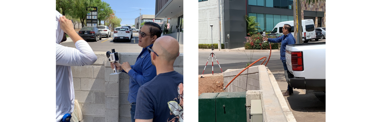
Scanning Procedure
4.3 Point Cloud Processing
After the scanning, data were exported directly from the H1 into processing software, where they were cleaned, aligned, and adjusted to generate an accurate georeferenced point cloud for further analysis. The integrated GNSS antenna ensured that the point cloud already carried precise coordinates, reducing the need for additional georeferencing steps.
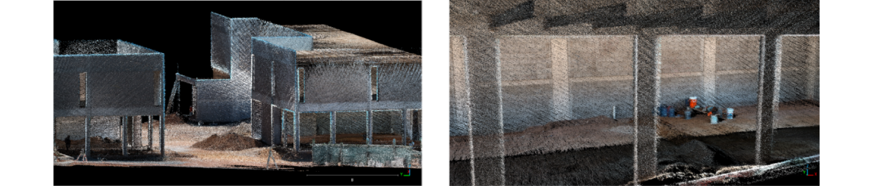
Point Cloud Data in Post-Processing App
5. Results
The H1 enabled rapid digital documentation of the construction site, producing a georeferenced 3D point cloud for progress monitoring. With accurate and up-to-date spatial data readily available, the project team could supervise construction remotely, significantly reducing travel requirements between the headquarters and the job site. The resulting digital record also provided a reliable basis for progress comparison, project documentation, and more efficient construction management.

Point Cloud Data
6. Customer Quote
The survey of approximately 2,000 m² was completed in less than 10 minutes using the H1 SLAM system. Considering the travel times and costs between La Paz and Culiacán, as well as the field inspection and documentation activities, the solution made it possible to have up-to-date information on the project in a single workday, avoiding recurring trips by technical personnel and significantly reducing the time associated with on-site monitoring.
– KALER Soluciones Geomáticas, SingularXYZ Mexico Partner
About SingularXYZ
SingularXYZ specializes in high-precision GNSS PNT (Positioning, Navigation & Timing) technology, delivering reliable and professional products, solutions, and services for both cross-industry applications and specialized vertical markets, such as geospatial surveying, precision agriculture, machine control, robotics and IoT.
With operations covering over 120 countries and regions, SingularXYZ holds over 40 patents and software copyrights and complies with ISO management system standards. The company is also recognized in China as a National High-Tech Enterprise, an SRDI Enterprise (Specialized, Refined, Differentiated and Innovative), and an Innovative Enterprise. Supported by a dedicated R&D team and a 1,000 m² office and development facility, the company continues to invest steadily in technology innovation and product development.
SingularXYZ is committed to bringing high-precision positioning and intelligent technologies into practical use, supporting digital, efficient, and intelligent systems that underpin everyday operations across industries and broader society.
About KALER Soluciones Geomáticas
At KALER, we transform technical knowledge into strategic solutions for the land. With over 25 years of experience in applied geomatics, we are leaders in Legal Surveying, Expert Reports, Land Use Planning, and Civil Engineering with a geospatial focus.
Our team combines academic excellence and technological expertise—GIS, GNSS, drones, LiDAR—to offer precise, reliable, and contextualized analyses. Every project we undertake stems from a clear vision: the land is more than just soil; it is history, law, and future.
That's why we work alongside public, private, and judicial institutions, providing legally sound technical support, from the initial boundary demarcation to the final planning model.